Limington Geography
The town of Limington comprises the eastern portion of the lands between the Saco and Little Ossipee Rivers watersheds, located in the very northeastern part of York County, Maine. Limington is slightly over nine miles long, with an average width of five miles. It is bounded on the north by Baldwin, on the east by Standish, on the south by Hollis and Waterboro, and on the west by Limerick and Cornish. The Saco River forms the boundary on the north and east sides while the Little Ossipee separates it from Waterboro on the south.

The highest point in Limington, Sawyer Mountain, rises 1,100 feet above sea level. In 1884 the U.S. Geological Survey placed a stone tower fifteen feet high upon its most prominent point. Later the tower was struck by lightning and now only scattered stones remain. There are seven ponds which cover 1,635 acres of the town. Four of these, Boyd, Dole, Foss and Sand Ponds, are in South Limington. The remaining three, Horn, Ward and Webster Ponds are in North Limington.
Limington History In Brief
Beginning in 1625 Plymouth began trading surplus corn to the eastern Abenaki on the Kennebec River (Maine) for furs. In 1668 Captain Sandy, an Indian chief, sold Francis Small a large tract of land embracing the territory between the Great and Little Ossipee Rivers where the village of Cornish now stands.
The Saco River and its tributaries were home of the Sokokis Indians. By 1776, Maine had been cleared of all recognizable tribes except the Penobscots and the Passamaquoddies. The Maine Indians were Abenakis, belonging to the great Algonquin stock.
At the beginning of the seventeenth century they occupied all the most desirable locations along the coast and up the lower sections of all the Maine rivers. The interior of the state was their hunting ground. The principal residences of their chiefs or Sagamores was upon Indian Island just above the Lower Falls where Saco village now stands. Small groups of Indians would come up the Saco River and camp near the mouth of the Little Ossipee in East Limington.
One of the last such visits of an Indian family was reported on the Little Ossipee River in October 1845. This small area known as “Indian reservation” was flooded when the dam was built at Bonny Eagle Pond.
The “Pequawket Trail” has not been used by the Pequawkets of Lovell’s Pond for over 200 years and has mostly been obliterated by time. It was originally the main thoroughfare between the coast and the White Mountains.
It has been said that the Pequawkets made an annual trip from Fryeburg, the ancient home of the tribe, down to the coastal area for the summer months where clams, fish and the like were easily obtained.
Maine State Route 113 was named Pequawket Trail in the late 1990’s.
Text adapted from:
History of Limington, Maine by Robert L. Taylor
Copyright 1991
Heritage Books, Inc.
1540 Pointer Ridge Place
Bowie, MD
Phone: (301) 390-7709
The Limington Historical Society
If you want to find out more about Limington history, you can get in touch witrh the Limington Historical Society.
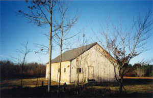
The society holds many events of historical interest and keeps archives and artifacts, as well as some historical buildings.

To find out more about the Limington Historical Society, please visit their website:
https://www.limingtonhistory.org/
To join the Society, you can email the secretary at:
secretary@limingtonhistory.org
York County Genealogical Resources are available online at:
http://www.raynorshyn.com/megenweb/york/.